(français ci-dessous)
Dear Readers
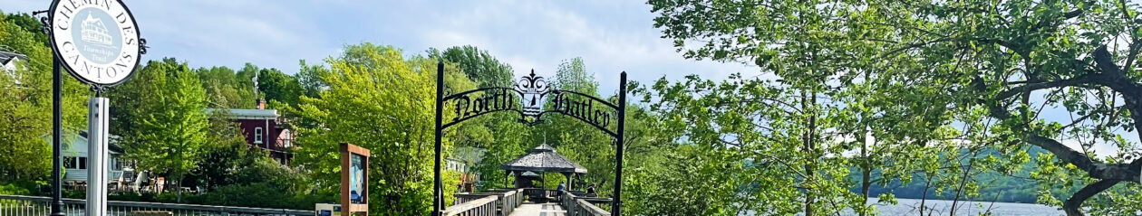
On behalf of the community of North Hatley, many thanks to everyone who participated, by writing and reading, in our recent series, Mon village, North Hatley / My North Hatley. It was our goal to put memories, hopes and visions out there for all to embrace while the Town and its citizens were engaged in the first phase of the Strategic Planning process. Your contributions become the Voice of the Village!
We know that your messages will help guide the Strategic Planning Committee to formulate a broad, inclusive vision in the production of their report, due to take place this autumn. The report’s recommendations are scheduled to be implemented by the Town this winter.
North Hatley is positioned to become a leadership community for environmental awareness. Working with established, volunteer-based organizations, we can promote a form of year-round tourism that is focussed on eco-friendly activities as we build this awareness. Our built heritage is as important as any new buildings we plan and its preservation and repurposing can also be an attraction. By envisioning and putting into place a long-term development plan we will enact a sustainable welcome for young families and businesses while protecting our unique history and environment. And North Hatley must resolve its financial instability, perhaps by uniting with our neighbouring community.
At the same time, North Hatley must, as so succinctly voiced by Hubert T. LaCroix and supported by the NHRS, augment and maintain the present recreational activity centres for the benefit of the community.
Let us continue to encourage our administration and Espace Stratégies — informed by the Strategic Planning Committee and its use of current and past studies and theses, and heartfelt messages from citizens with personal histories and future dreams, viewed not as interference but as collective thinking — to move us towards those goals.
The Fanhca team, August 25, 2020.
____________________
Chers lecteurs
Au nom de la communauté de North Hatley, un grand merci à tous ceux qui ont participé, par écrit ou par la lecture, à notre récente série, Mon village, North Hatley / My North Hatley. Notre objectif était de mettre des souvenirs, des espoirs et des visions à la portée de tous pendant que la municipalité et ses citoyens étaient engagés dans la première phase du processus de planification stratégique. Vos contributions deviennent la Voix du village!
Nous savons que vos messages aideront le Comité de planification stratégique à formuler une vision large et inclusive dans la production de son rapport, qui doit avoir lieu cet automne. Les recommandations du rapport devraient être mises en œuvre par la municipalité cet hiver.
North Hatley est en position de devenir une communauté faisant preuve de leadership eu égard à la sensibilisation à la protection de l’environnement. En travaillant avec des organisations bien établies et fondées sur le bénévolat, nous pouvons promouvoir une forme de tourisme à longueur d’année qui se concentre sur des activités respectueuses de l’environnement, tout en développant cette prise de conscience. Notre patrimoine bâti est aussi important que les nouveaux bâtiments que nous prévoyons et sa préservation et sa réutilisation peuvent également constituer un atout. En envisageant et en mettant en place un plan de développement à long terme, nous instaurerons un accueil durable pour les jeunes familles et entreprises tout en protégeant notre histoire et notre environnement uniques. Et North Hatley doit résoudre son instabilité financière, peut-être en s’unissant à notre communauté voisine.
En même temps, North Hatley doit, comme l’a si succinctement exprimé Hubert T. LaCroix , appuyé par la Société récréative de North Hatley, augmenter et maintenir les centres d’activités récréatives actuels au profit de la communauté.
Continuons d’encourager notre administration et Espace Stratégies à nous faire avancer vers ces objectifs – éclairés par le Comité de planification stratégique et son utilisation des études et thèses actuelles et passées, et des messages sincères de citoyens, avec leurs histoires personnelles et rêves pour l’avenir, perçus non comme de l’interférence mais comme une réflexion collective.
L’équipe Fanhca, le 25 août 2020.