(français ci-dessous)
The ongoing saga of Virgin Road
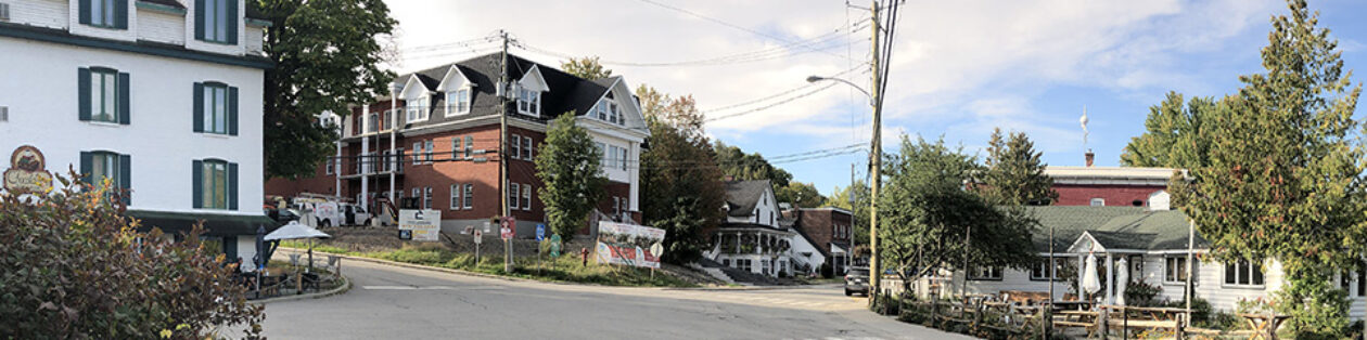
Once upon a time, Virgin Road was a steep, narrow, tree-lined lane in the western extremity of North Hatley, linking chemin de l’Université to chemin Magog. Except for short cul-de-sacs at each end, it was closed to traffic at the end of the 1970s, due to the difficulty of maintaining it and challenging winter conditions. But it remained a 40 ft wide (12 m) municipally owned right-of-way, which became a treasured walking path to those lucky citizens who knew of it.
I discovered it in the 1980s, long before I moved to North Hatley. It was part of our favorite ski trail, SkiWippi, which linked Auberge Hatley to Manoir Hovey and then on to Ripplecove Inn in Ayer’s Cliff. After moving to North Hatley in the early 2000s, I often wandered up the Virgin Trail, drawn by the magnificent southward views it gave on Lake Massawippi.
Unfortunately, no efforts were ever made by the Town to maintain or improve the pathway, or even to signal its existence. It was ignored except for clumsy municipal efforts to deal with erosion at its lower end where a short stretch of Virgin Road still gave access to a few properties, including Auberge Hatley.
The saga of this beautiful trail probably began when the Auberge burned down in 2006, although it was not until 2012 that its very existence was in high jeopardy. A deal had been reached behind closed doors to give away 80% of this right-of-way, including scores of mature maple and oak, which would be cut down to make way for a “private service road” giving access to a number of large lots being offered for sale by the owners of the former inn. The Town would have retained a totally unusable 6 ft wide strip on the high bank flanking the corridor. Click here for more info on this.
In fact, the Town was about to give away 3000 m2 of public land in exchange for 600 m2 of private land on which turning circles would have been built at the lower and upper ends of the public road. This deal was stopped at the last minute when the Town’s Environment Committee* (see end note) found out about it. We visited the site with Mayor Page. While he agreed that the municipality should retain control of this corridor in its entirety, no steps were taken to give it any kind of long-term protection. We also insisted at the time that a municipality has the power to protect a view. The mayor agreed that, part way up the trail, there was an amazing panoramic view of the lake and a picnic table was placed there, but again no measures were taken to protect this natural treasure, unrivalled by any other public viewpoint in North Hatley.
Fast forward to 2020. The view is gone, completely blocked by a very long new home. The quiet cul-de-sac has been extended a little further up the hill and transformed into a major roadway. The huge turning circle, so narrowly stopped 8 years previously, has happened. Although it is mainly sited on private land, many mature trees mostly on town land have been sacrificed in the process. Two major rock-filled ditches have been cut into the terrain, one crossing the former pathway and the other along the northern edge of the extended roadway. We have been told by the mayor and by the town foreman that all of this has been done in conformity with the town’s norms.
It is very convenient to hide behind norms. However, unless they relate to public safety, they are only a guide to what could be done in certain situations and when required. It is totally unjustifiable to treat this cul-de-sac as if it were a major thoroughfare. During a spell working for the Quebec Government as a regional planner, one of my dossiers focused on excessive road-building norms. We proposed more moderate and environmentally acceptable options, while stressing the need to adapt them to fit particular situations. For example, when planning to widen a stretch of tree-lined highway, do we simply eliminate all those “troublesome” trees, or do we look for more intelligent solutions? The fact is that “Beauty is in the eye of the beholder”. What some might see as necessary signs of progress, others will see as wanton destruction.
How is it that at the upper end of Virgin Road, where it meets chemin de l’Université, a simple no-frills cul-de-sac provides discreet access to Clematis Farm (formerly the Virgin family property)? Perhaps more tedious for the drivers of snow plows, service trucks and so on, but nonetheless perfectly manageable. Why does the lower end require an indisputably ugly, platinum-coated solution? In Pascale Galipeau’s words, this is an entry of pharaonic proportions: not only very costly, regardless of who pays the bill, but highly destructive environmentally. Is this all part of the much-vaunted Strategic Planning process? Confront the public with a fait accompli, then make all kinds of empty justifications, when the damage is irrevocable.
The mayor told us that bushes or trees would be planted to replace more than a dozen mature maples and oaks which suddenly succumbed to the chainsaw. Not because they were unhealthy, but because they were inconveniently situated. Surely the mayor can understand that older trees offer far greater climate benefit, not to mention beauty and shade. Some sources say that at least 20 trees need to be planted to replace one mature specimen, and in their first years will provide little or no benefit. Mortality also takes its toll: few of those young trees will ever make it to maturity.
The condition of trees standing on top of the steep bank on the upper side of the Virgin Hill corridor is very precarious, and made more so over the years by inappropriate attempts by the Town to deal with erosion. There would have been more subtle and sensitive solutions, if the Town had cared to look for them. The Environment Committee raised this issue in 2012, but to no avail.
*As with so many other volunteer groups in NH, this town-appointed committee gave up the ghost after being increasingly muzzled by the Town for the positions it was taking on “hot dossiers”.
This all brings me to wonder about a few things:
- How many councilors were even aware of this beautiful trail and of the exceptional viewpoint it afforded?
- How many councilors have gone to see this depressing transformation since the summer, when these issues were first brought to the Town’s attention?
- Could all of this wanton destruction happen without their knowledge? If so, it implies a dangerous degree of autonomy for the town foreman and/or the temporary inspection service provided last summer by EXP Consultants.
- Moreover, I must admit to feeling some doubt when, on November 8th, I was told by both the property owner and the mayor that this costly road extension did not cost the Town a penny.
- While the mayor keeps insisting that this pathway will remain open (at least as long as he is mayor), we continue to witness alarming degradation during his watch.
- Will the Town now take some steps to improve the condition of the remaining part of this public path and give it permanent protection?
- Will the Town look for ways of creating and protecting the remaining viewpoint further up the trail, where the new construction only partially masks the view? Or must we continue to squander our common heritage?
One last thought: I feel there is an urgent need to bring back citizen committees as part of a more open dialogue between the Town and the population, and as a way to relieve pressure on overworked elected officials. However, these committees can only work if treated as collaborators rather than potential obstacles. Intelligent planning takes time; there should be no urgency to hand out permits. The landscape or townscape can be irrevocably defaced by high-end norms being blindly applied, by 50 year-old trees being eliminated in a matter of minutes and by other short-sighted or possibly inappropriate planning decisions. There has to be a forum for discussion and oversight which should not remain the sole domain of the Town Council. Every town needs its mini-BAPE (Bureau d’audiences publiques sur l’environnement).
Michael Grayson, November 15, 2020
________________________________
La saga du chemin Virgin continue
Il était une fois le chemin Virgin : une ruelle escarpée, étroite et bordée d’arbres à l’extrème ouest de North Hatley, reliant le chemin de l’Université au chemin Magog. A l’exception de courts culs-de-sac à chaque extrémité, il a été fermé à la circulation à la fin des années 1970 en raison de son entretien problématique et des conditions hivernales difficiles. Mais il est resté une emprise municipale de douze mètres de large, qui est devenue un sentier pédestre précieux pour les citoyens chanceux de connaître son existence.
Je l’ai découvert dans les années 1980, bien avant de déménager à North Hatley. Il faisait partie de notre piste de ski de fond préférée, SkiWippi, qui reliait l’Auberge Hatley au Manoir Hovey, puis à l’Auberge Ripplecove à Ayer’s Cliff. Après avoir déménagé à North Hatley au début des années 2000, j’ai souvent parcouru le sentier Virgin, attiré par les magnifiques vues vers le sud qu’il offrait sur le lac Massawippi.
Malheureusement, aucun effort n’a jamais été fait par la municipalité pour maintenir ou améliorer ce sentier, ou même pour signaler son existence. Il a été ignoré, mis à part les efforts municipaux maladroits pour contrer l’érosion à la partie du bas, avant qu’il rejoignait le court tronçon de rue qui desservait encore quelques propriétés, dont l’Auberge Hatley.
La saga de ce beau sentier a probablement commencé lorsque l’auberge a brûlé en 2006, même si ce n’est qu’en 2012 que son existence même a été mise en danger. Un accord avait été conclu à huis clos pour céder 80 % de cette emprise, y compris l’abattage de douzaines d’érables et de chênes matures, dans le but de faire place à une « voie de service privée » donnant accès à quelques grands terrains proposés à la vente par les propriétaires de l’ancienne auberge. Le village aurait conservé une bande de six pieds de large, totalement inutilisable sur la rive haute du couloir. Cliquez ici pour plus d’informations à ce sujet (en anglais).
En fait, la municipalité s’apprêtait à donner 3000 m² de terres publiques contre 600 m² de terrain privé sur lequel elle aurait construit des boucles de virage aux deux extrémités du chemin. C’est à la dernière minute que cet accord a été révoqué, lorsque le Comité consultatif sur l’environnement du village* en a eu vent. Nous avons visité le site avec le maire Page et il était d’accord que la municipalité devait conserver l’emprise en entier, mais aucune mesure n’a été prise pour la protéger de manière perpétuelle. Nous avons également insisté à l’époque sur le fait qu’une municipalité a le pouvoir de protéger une vue. Le maire reconnaissait qu’il y avait une vue panoramique magnifique sur le lac, un peu plus haut sur le sentier. Une table de pique-nique y a été placée, mais cette fois encore, aucune mesure n’a été prise pour protéger ce trésor naturel, qui n’avait comme égal aucun autre point de vue public à North Hatley.
Nouveau constat en 2020 : La vue panoramique n’existe plus, complètement bloquée par la construction d’une maison neuve. Le cul-de-sac tranquille a été prolongé un peu plus haut sur la colline et transformé en une rue disproportionnée aux besoins. L’énorme boucle de virage, arrêtée huit ans auparavant, a été mise en place. Bien qu’elle soit située principalement sur du terrain privé, de nombreux arbres matures, en grande partie dans l’emprise municipale, ont été sacrifiés dans le processus. Deux fossés importants remplis de roches ont été creusés en bordure de la rue, l’un à travers qui coupe l’ancien sentier et l’autre situé le long de la rue prolongée, côté nord. Le maire et le contremaître municipal nous ont dit que tout cela a été fait conformément aux normes du village.
Il est facile de se cacher derrière des normes. Cependant, à moins que de telles normes ne concernent la sécurité publique, elles ne constituent qu’un guide de ce qu’on peut faire dans certaines situations si besoin est. Il est totalement injustifié de traiter ce cul-de-sac comme s’il s’agissait d’une artère majeure. Quand, pendant un certain temps, j’ai travaillé pour le gouvernement du Québec en tant que planificateur régional, un de mes dossiers portait sur les normes excessives de construction routière. Nous avons proposé des options plus modérées et plus acceptables sur le plan environnemental, tout en soulignant la nécessité d’adapter toute norme à des situations particulières. Par exemple, lorsque on prévoit élargir un tronçon de route bordée d’arbres, doit-on simplement éliminer tous ces arbres « gênants » ou chercher des solutions plus intelligentes ? Le fait est que « la beauté est dans l’œil de celle ou de celui qui la découvre ». Ce que certains pourraient considérer comme les signes nécessaires de progrès, d’autres y verront une destruction néfaste.
Comment se fait-il qu’au bout du chemin Virgin, là où il rencontre le chemin de l’Université, un simple cul-de-sac offre un accès discret à Clematis Farm (terrain appartenant à la famille Virgin autrefois) ? Peut-être plus difficile pour les conducteurs de chasse-neige et de camions de service, mais néanmoins parfaitement manœuvrable. Pourquoi l’extrémité inférieure nécessite-t-elle une solution incontestablement moche et princière ? Pour reprendre les mots de Pascale Galipeau, il s’agit d’une entrée aux proportions pharaoniques : non seulement très coûteuse, peu importe qui paye, mais également extrêmement destructrice pour l’environnement. Tout cela fait-il partie du processus de Planification stratégique tant vanté ? Confrontez le public avec un fait accompli, puis offrir toutes sortes de justifications creuses, lorsque le dommage est irrévocable.
Le maire nous a dit que des buissons ou des arbres seraient plantés pour remplacer plus d’une douzaine d’érables et de chênes matures qui ont soudainement succombé à la tronçonneuse. Pas parce qu’ils étaient malsains, mais parce qu’ils étaient mal situés. Le maire peut sûrement comprendre que les arbres plus âgés offrent un bien plus grand avantage climatique, sans parler de leur beauté et de l’ombre. Certaines sources maintiennent qu’au moins vingt arbres doivent être plantés pour remplacer un seul spécimen mature, et au cours de leurs premières années ils fourniront peu ou pas d’avantages. La mortalité fait également des ravages : peu de ces jeunes arbres parviendront à maturité.
L’état des arbres sur la rive escarpée du chemin pédestre Virgin est très précaire, rendu encore plus incertain au fil des ans par les tentatives inappropriées du village de faire face à l’érosion. Il y aurait eu des solutions plus subtiles et plus sensibles, si la municipalité s’était souciée de les chercher. Le Comité consultatif sur l’environnement a soulevé cette question en 2012, mais en vain.
*Comme beaucoup d’autres groupes de bénévoles de North Haltey, ce comité nommé par la municipalité a rendu l’âme après avoir été de plus en plus muselé par la municipalité pour les positions qu’il prenait dans des « dossiers chauds »
Tout cela m’amène à m’interroger sur les éléments suivants :
• Combien de conseillers connaissaient même l’existence de ce beau sentier et du point de vue exceptionnel qu’il offrait ?
• Combien de conseillers sont allés voir cette transformation déprimante depuis l’été, lorsque ces questions ont été portées à l’attention de la municipalité ?
• Est-ce que toute cette destruction inutile a pu se produire à leur insu ? Si oui, cela implique un degré d’autonomie dangereux accordé au contremaître municipal ou au service d’inspection temporaire fourni cet été par le groupe EXP.
• De plus, je dois avouer avoir un certain doute quand, le 8 novembre, le propriétaire et le maire m’ont dit que cette nouvelle infrastructure ne coûtait pas un sou au village.
• Alors que le maire ne cesse d’insister sur le fait que ce sentier restera ouvert (du moins tant qu’il sera maire), nous continuons d’assister à une dégradation alarmante sous son administration.
• La municipalité prendra-t-elle maintenant des mesures pour améliorer l’état de ce qui reste de ce sentier public et pour lui accorder une protection permanente ?
• La municipalité cherchera-t-elle les moyens de protéger le point de vue qui s’offre encore plus haut sur le sentier, où la nouvelle construction ne masque que partiellement la vue ? Ou continuerons-nous à gaspiller notre patrimoine commun ?
Une dernière pensée : je sens qu’il y a un besoin urgent de rétablir des comités de citoyens afin de créer un dialogue plus ouvert entre l’administration du village et la population ; ce serait aussi un moyen de soulager la pression sur les élus surchargés de travail. Cependant, ces comités ne peuvent fonctionner que s’ils sont traités comme des collaborateurs. La bonne planification prend du temps ; l’accord d’un permis ne devrait pas être traitée en urgence. Le paysage naturel ou urbain peut être irrévocablement dégradé par des normes excessives appliquées aveuglément, par l’élimination en quelques minutes d’arbres imposants et par d’autres décisions de planification myopes ou éventuellement inappropriées. Il doit y avoir un forum de discussion et de vue d’ensemble qui ne doit pas rester le seul domaine du conseil municipal. Chaque village a besoin de son mini-BAPE (Bureau d’audiences publiques sur l’environnement).
Michael Grayson, le 15 novembre 2020
Thank you to Michael Grayson. I am glad he laid out all the facts and the history of the road, especially this recent history. What a shame. It is a shame that a beautiful place has been sullied.
It is a shame that it all happened behind closed doors and without open process.
During the past many years my daughter has painted several lovely oil and watercolor paintings of the treasured view from Virgin Hill. Our dogs have enjoyed romping along the trail, meeting other dogs, and sniffing out wildlife under the canopy of the ancient trees. Hikers and walkers have taken in the natural beauty in peace and quiet.
I feel sorry about these scars to North Hatley’s landscape that cannot be undone.
Faith McClellan LeBaron
Albert Einstein disait: « il ne faut pas compter sur ceux qui ont créé les problèmes pour les résoudre. »
“Do not rely on those who created the problems to solve them” said Einstein!